Salt Ponds to Ocean Swells:
Paddling the Sakonnet River in Rhode Island
By Tamsin Venn.
Rhode Island's 400 miles of coastline has a wide variety of paddling environments ranging from high sea cliffs and large swells to sheltered salt ponds, coves, and marshes to long miles of beautiful barrier beach. The state has particularly dramatic paddling at the south end of Narragansett Bay where the bay meets open ocean head on, and huge waves break against cliffs below Newport's mansions.
Newport reigns as the sailing capital of the East and is the start or finish of the world's great sailing races, including the Newport-to-Bermuda Race every other year, the OSTAR singlehanded Round-the-World Race, the TransAtlantic Race, and in the past the America's Cup trials. Between Newport and Mystic, Connecticut, you can probably see the best collection of handsome and historic boats anywhere.
While sea kayaking in Rhode Island can be dramatic, scenic, or feisty, the experience is influenced by several factors, a major one being the U.S. Navy, which has several installations in Newport. The Navy prohibits landing or launching on most of Newport-area shoreline and has ships that throw off huge, tricky wakes. In addition, Newport is a major shipping port, and barges and freighters the size of apartment buildings go in and out of the bay pulled by tugboats, in addition to ferries, large ocean crossing sailing craft, fishing trawlers, historic tall ships, lobster and quahog boats, ocean going fishing pleasure boats, and jet skis. The bay is a very busy place, and it is usually best to paddle in the off season or avoid major crossings in summer. All of Rhode Island's bridges are vertigo-inducing high to accommodate large ships.
Three passageways extend from Rhode Island Sound inland as far as Providence and Fall River. The far-east side is the wide and straight Sakonnet River from Sakonnet Point on the Atlantic to Mount Hope Bay. The west side's large islands of Prudence and Conanicut plus several smaller islands divide Narragansett Bay into a West and East Passage. The East Passage that goes by Newport is the busiest. The island of Aquidneck, with Newport at its tip, divides the East Passage and Sakonnet River.
It should be noted that waters around Newport and the Providence River can be polluted with sewage overflows, toxic wastes from industry, and toxic run-off from roads, a situation that an environmental organization called Save the Bay is doing much to correct. Shellfishing in the northern bay is often closed after rainstorms. In contrast, the mouth of Narragansett Bay is pristine because of lack of industry and daily flushing by the Atlantic.
To the southwest of Narragansett Bay lies the south shore, 20 miles of superb beaches protecting large saltwater ponds from Narragansett to Watch Hill. The Pawcatuck River, along the Connecticut border, empties into Little Narragansett Bay at Watch Hill.
A good source of public access points is Rhode Island Sea Grant's Explore Rhode Island Shore. The site provides information on more than 340 public access points along the state's coast. The guide describes selected parks, wildlife refuges, beaches, fishing sites, boat ramps, pathways and views along the state's coast. Another useful book is A Guide to Rhode Island's Natural Places, also available from the Sea Grant.
Still another source is the ExploreRI mapper posted by Rhode Island Blueways, with interactive water trail maps and a boat ramp list, both trailer and hand carried.
Great resources all in this Ocean State.

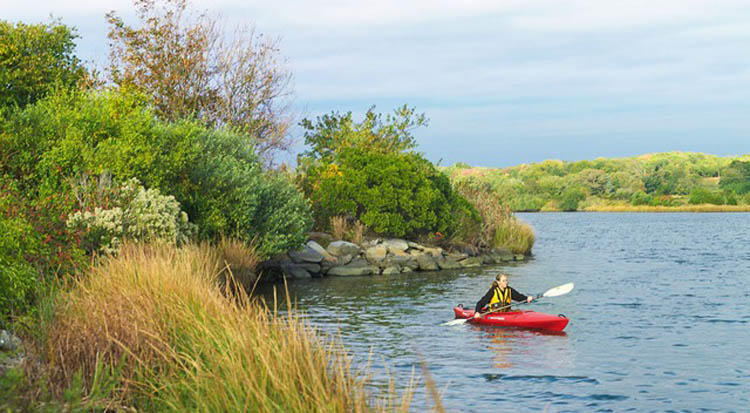
The Sakonnet River offers some relatively rural coastal paddling. Fogland Preserve. Credit The Nature Conservancy.
Sakonnet River: Sakonnet Point to Tiverton
Charts and Maps: NOAA # 13221 at 1:47,000 and #13223 at 1:46,500 (if you want to paddle to Newport)
Trip Mileage: 15 miles (one way)
Access and Directions: Sakonnet Harbor: From I-195, take RI 24 south. At Tiverton before crossing the bridge, bear left on RI 77. Follow RI 77 through Four Corners all the way to the end at Little Compton. Bear right on Sakonnet Point Road to harbor. Parking is on the left. Launch is across the street. Directions to the take out at The Cove, north part of Portsmouth. From Bristol, take the Mt. Hope Bridge to RI 24 north to the unmarked dirt road on the right before reaching Hummock Ave. The road leads to a former concrete ramp and plenty of parking.
Tidal Range: 3.1 feet at Sakonnet
Caution Areas: At Almy Point, the channel narrows radically, with strong currents of 4—5 knots. A quiet eddy line on the east shore is complicated by the risk of entanglement in lines from those fishing from what remains of the Old Stone Bridge.
While much of Rhode Island's coastal zone is densely populated, the eastern shore by contrast has been left to the farmers, dairy cows, and vintners. The Sakonnet River is the most easterly of three passages leading through Narragansett Bay, so it is actually an inlet of the Atlantic Ocean. Many paddlers find it the most inviting because of the rural shoreline and quiet waters removed from the bay's prolific boat traffic of commerce, government, and pleasure.
A good way to enjoy the Sakonnet River's length without doubling back is to start at Sakonnet Point in Little Compton but spot a car in Tiverton. The view from the river is one of long fields with cows and silos, stone walls and shingled houses, rose bushes and windmills, looking probably much as it did several hundred years ago. The original settlers were a band of explorers from Plymouth Colony seeking to expand; they bought 20 square miles on the peninsula from the Sogkonnite tribe of Indians. Later settlers are famous for having developed the famous Rhode Island Red chicken breed (you can see a monument to the breed in nearly Adamsville). The coastline is broken by beaches and marshy inlets.

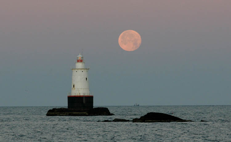
The Sakonnet Point Light on Little Cormorant Rock. Credit Friends of Sakonnet Lighthouse.
Sakonnet Harbor is small and snug, protected from northwest winds by a breakwater. Park in the lot next to the Haffenreffer Wildlife Preserve and carry your boat across the street to the paved launch ramp. The view to the west is to the Sakonnet Point Light on Little Cormorant Rock. Built in 1884, officials discontinued the light in 1955, then relit it in 1997 — it flashes white every six seconds with a red sector.
Carl Haffenreffer, president of Narragansett Brewing, bought the lighthouse for a little more than $1,000 at auction in 1961, but donated it to the Friends of Sakonnet Point Lighthouse in 1985 so they could maintain it.
Beyond you can see the cliffs dropping into the sea at Newport. It is a tempting thought to paddle over to Newport (a round trip from Sakonnet Harbor of at least 20 n.m.), but conditions need to be fairly calm because of the long, exposed crossing.
Sakonnet Point is a dramatic spot but also very exposed when the wind is blowing 15 mph or more from the southwest. From Sakonnet Harbor, hug the shore past Church Cove, Church Point, around Fogland Point to Sapowet Point to Nannaquatek Neck. The shore has several beaches, a few interesting sailboats, and pretty tidal marsh estuaries to poke around in at high tide such as Nonquit Pond or Sapowet Creek. For a shorter trip, consider paddling as far as Fogland Point beach, about half way between Sakonnet and Tiverton.
At the south end of Nannaquatek Neck, turn right (east) into the gut to the quiet and rural Nannaquatek Pond, surrounded by private homes and carefully spotted picnic tables, with osprey diving overhead.
Back on the Sakonnet River, the view from Nannaquatek Neck is dominated by the large Mt. Hope Bridge, a 135-foot-high fixed bridge that spans Mt. Hope Bay from Bristol Neck to Aquidneck Island. Beyond is sprawling Fall River. At Almy Point, pass through the narrow passage, which connects the Sakonnet River to Mt. Hope Bay. The current rushes through at upwards of 5 knots and is one of the strongest in Narragansett Bay. Please check your tides. The jetty on the east side is the former Old Stone Bridge, which used to connect Almy Point to Rhode Island, and from which many fishermen cast their lines. Just to the north is the Tiverton Yacht Club. Cross the river. Paddle under the bridge at Hummock Point into The Cove, then straight across (west) to the takeout.
On your drive back down Route 77 to Sakonnet Point to pick up your car, stop at one of the many farmstands, or famous Gray's homemade ice cream in Tiverton Four Corners (crossroads of Main road/RI 77 and East Road/RI 179). It is currently open for call-ahead orders including pints and quarts, which can be picked up from the general store entrance. You can also visit the renowned Carolyn's Sakonnet Vineyards in Little Compton. The tasting room is closed, but online orders are available for curbside pick-up. Salty sea breezes, occasional rains, and rolling fog all add striking flavors to the grapes at New England's oldest vineyard, the winery proclaims.

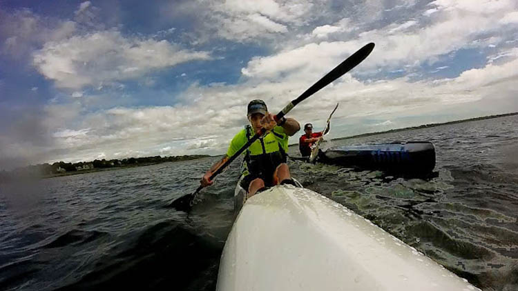
Greg Lesher pushing hard during the Sakonnet River Race. Photo by Greg Lesher.
Other Options: Should the water be too choppy at Sakonnet Point, head farther down the peninsula and put in at the Sapowet Point Ramp, which can be reached by turning west onto Neck Road in Tiverton Four Corners at the Provender food market, then north onto Sapowet Ave. From here you can explore the Sapowet (also spelled Seapowet) Marshes. You can also launch from Fogland Beach, which juts out into the river. From Main Rd./RI 77 turn west on Fogland Rd., and follow to end to launch ramp. Limited parking at the ramp, but ample parking (fee in season) is available at the town beach to the northwest (right). Fogland Marsh Preserve, drained by Almy Brook from Nonquit Pond, is managed by The Nature Conservancy and is one of the few unditched marshes in Rhode Island. Most are drained by ditches for mosquito control. The Preserve itself is currently closed due to Covid-19.
